News:

This discussion group is best enjoyed using Google Chrome, Firefox or Safari.


Richard DeMenna

  • Karma: +0/-0
Re: The Links Club - Now with Photos
« Reply #75 on: January 19, 2022, 08:24:08 PM »
Here is a prized possession of mine.


Phil Carlucci

  • Karma: +0/-0
Re: The Links Club - Now with Photos
« Reply #76 on: January 19, 2022, 09:27:54 PM »
It's not really clear from Bahto's book or from the articles I have in my files when play actually ceased on the course.  It is clear there were pretty strong efforts by both the village and the town of North Hempstead to purchase the land and prevent the development, but neither could come up with the cash.  Construction of the new housing didn't begin until 1988-89.

One thing I found that was interesting was that in the early 1960s when Nassau County was stockpiling open space to convert to county parks, one of the sites they wanted was the Links Club.  Evidently the village and the club members told the county to go to hell, which led Nassau to instead purchase a nearby estate that they would convert to Christopher Morley Park (today home to one of the County's four nine-hole munis).

Of course, in its boundless wisdom, Nassau, on its county parks web page, describes Morley Park as the site of a former estate that "included the Links Golf Club."
Golf On Long Island: www.GolfOnLongIsland.com
Author, Images of America: Long Island Golf

Bret Lawrence

  • Karma: +0/-0
Re: The Links Club - Now with Photos
« Reply #77 on: January 20, 2022, 11:07:09 AM »
The last batch of photos.

The Reverse Redan at the 13th -


A shot from the 15th Tee -


Further down the 15th -


The 16th Hole (with 17th Tee to the right and the 2nd and 3rd in the background) -


The 18th Hole -


Richard,


Thank you for sharing your pictures and information on the Links Club. This is very interesting to me.


Did you say someone came in to make changes to the course?  The pictures posted earlier in the thread show two styles of bunkering.  It seems like many of the Par 3’s have their original bunkers but the fairway bunkers on the first and all of the bunkers on the 18th almost have a saucer-type of look to them that don’t seem to match up with the earlier aerials.  I included some of the pics posted earlier in the thread to show the difference between some of the bunkers. The 18th hole used to be a Road Hole style green in the earliest layouts and aerials.  As you can see in the last picture above, the bunkers do not look like Raynor or Macdonald’s original road style bunkering. I am just curious who made the changes to the golf course?


Thanks again for sharing your information.


Bret


Richard DeMenna

  • Karma: +0/-0
Re: The Links Club - Now with Photos
« Reply #78 on: January 20, 2022, 11:47:26 AM »
The Biarritz photo is wonderful. What a visual to step up to and then have to pull the trigger.


Richard - Thanks for bringing these photos and memories to our attention. Was the front part of the Biarritz maintained as green or fairway? The back section appears brighter in the photo making me think only that was green, but it could be a trick of the light.


https://photos.app.goo.gl/sdEwuNSKyFfiGTmF7
Jim and Sven - Yes the front part was maintained as a fairway.  Depending on the trajectory of a short tee shot the ball could easily roll on to the green.  Another interesting note on the bunker, as I mentioned previously, most of sand on the course was coarse in consistency. Nothing like the fine texture I have seen in South Georgia and Florida. On this hole in particular, the pro would most often use his putter out of this deep trap. Joe had a knack of getting the ball out that way.  I am really happy in deciding to take a picture of this hole. First time players of this hole were often mesmerized when they first viewed it.

Richard DeMenna

  • Karma: +0/-0
Re: The Links Club - Now with Photos
« Reply #79 on: January 20, 2022, 12:06:08 PM »
Richard, great pictures.
Was there any elevation difference from the 3rd tee to the the 3rd green? It appears slightly uphill (to me) in that photo. Did members struggle with it or embrace it?
Thanks.
Peter,
There really was not much of a elevation difference.  If any, the 3rd tee was of higher elevation.  Once leaving the tee there was a steep decent down and then a gradual incline back to the green. This hole was always well received by players when reaching the tee box.  The green was in close proximity of the 17th green.  Those two greens were basically separated by the 4th tee.  Being in close proximity of the 17th green, the highest point on the course, panoramic views on the 3rd green (and the tee  box for that matter) were one for the books.

Tom_Doak

  • Karma: +1/-1
Re: The Links Club - Now with Photos
« Reply #80 on: January 20, 2022, 12:10:39 PM »
Phil:


The last few years, Bob Ranum from GCGC had helped them maintain the course, and most of the play was from retired firefighters and police.  The members were rarely around.  I am pretty sure I played it in 1985 and it didn’t last much longer.


Bret:  I don’t think anyone made changes to the course; the bunkers just evolved to the look shown over decades of very little attention.  Ben Zukowsky the superintendent was afraid to do anything that Mr Macdonald wouldn’t have approved.

Bret Lawrence

  • Karma: +0/-0
Re: The Links Club - Now with Photos
« Reply #81 on: January 20, 2022, 12:47:15 PM »
Tom:


I am guessing the work on the 18th hole was done between 1926 and 1940.


Here is a layout showing the plan for the 18th hole:

1926 Aerial, showing 18th hole as built (18th hole on the bottom of the frame)

1940 Aerial showing new fairway bunkers and different green side bunkers:


Bret

Richard DeMenna

  • Karma: +0/-0
Re: The Links Club - Now with Photos
« Reply #82 on: January 20, 2022, 12:55:55 PM »
Quick side note before moving on.

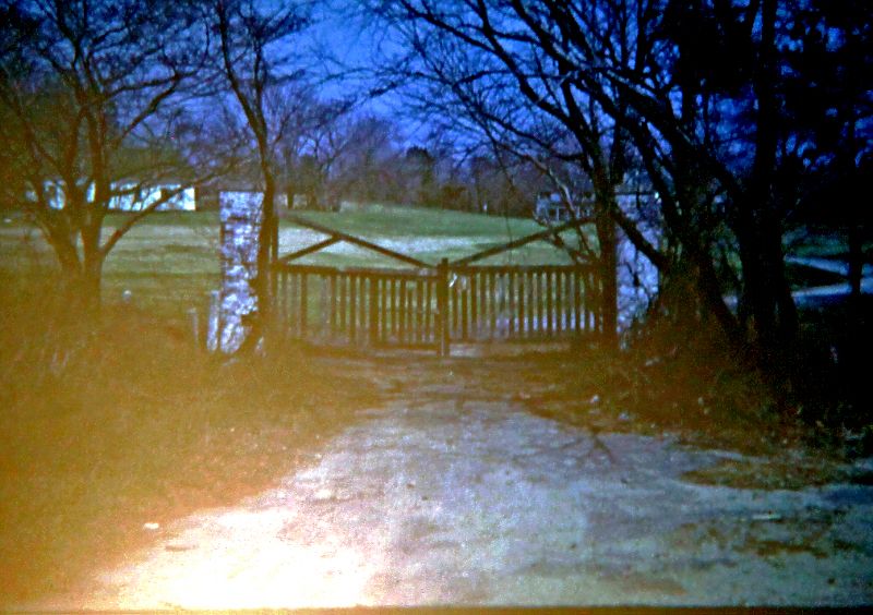
The club bordered the Long Island Motor Parkway (a phenomenon worthy of its own study).  The Parkway was a private roadway running along the breadth of Long Island.  There are reports of a handful of secret entrances along the way, including one from the grounds of The Links Club (pictured below).  Once you track the involvement of William K. Vanderbilt in both enterprises, it all makes sense.

It does beg the question if the proximity to the LIMP made the choice of the location for the club that much easier.


Tim Martin,

I am going to answer you Post 62 question by using this post by Sven. If you look to the building on the right that is the Clubhouse a converted farm house.  The building on the left, separated by the 10th fairway, is large farm barn.  This barn had a top level that housed the pro shop.  The pro and his wife, Joe and Julie Phillips, resided on that top level as well with modest accommodations.  This level also had a workshop for the pro and housed members golf bags.  The groundskeeper, Ben Zukosky, also stored his clubs there.  He and the Phillips dog, Laddie, would often have a turf war back there!

The bottom level of the barn was the groundskeepers domain. The of majority of the mechanical equipment was kept there.  During the winter months Ben's skeleton crew were busy servicing equipment.  Julie Phillips would tell me stories of how offensive the gasoline odor would permeate into there living quarters.

Detached from the barn was a deep large garage that housed a handful of golf carts.  They were discouraged at this Club.  Jock Whitney and William Paley were two of the most notable exceptions that had carts there.  The Phillips parked their cars there which included a first generation Ford Thunderbird. There was also a very old inoperable Model T that was stored there.  Also attached to the garage was the caddie house.  It had seen its better days when I first arrived on the scene and was hardly occupied. 

Behind the garage was a smaller barn but still large that housed fertilizer, chemical supplies, etc. and perhaps some additional machinery. This barn was adjacent to the 11th fairway. Sometimes balls from errant drives would find there way there.  Back on the course, there was somewhat of a maintenance area off to the left of the 2nd hole foot bridge.  It did not contain a building structure however.  Actually it was more of a dumpsite and to be frank an eyesore.
« Last Edit: January 20, 2022, 03:51:55 PM by Richard DeMenna »

Richard DeMenna

  • Karma: +0/-0
Re: The Links Club - Now with Photos
« Reply #83 on: January 20, 2022, 01:55:43 PM »
The last batch of photos.

The Reverse Redan at the 13th -


A shot from the 15th Tee -


Further down the 15th -


The 16th Hole (with 17th Tee to the right and the 2nd and 3rd in the background) -


The 18th Hole -


Richard,


Thank you for sharing your pictures and information on the Links Club. This is very interesting to me.


Did you say someone came in to make changes to the course?  The pictures posted earlier in the thread show two styles of bunkering.  It seems like many of the Par 3’s have their original bunkers but the fairway bunkers on the first and all of the bunkers on the 18th almost have a saucer-type of look to them that don’t seem to match up with the earlier aerials.  I included some of the pics posted earlier in the thread to show the difference between some of the bunkers. The 18th hole used to be a Road Hole style green in the earliest layouts and aerials.  As you can see in the last picture above, the bunkers do not look like Raynor or Macdonald’s original road style bunkering. I am just curious who made the changes to the golf course?


Thanks again for sharing your information.


Bret
Bret,
Those bunkers you are inquiring about were present when I first started as a caddie in 1966.  Incidentally we earned $5 per bag for a 18 hole loop.  In 1982, we were earning $20 per bag.

There were only a few minor modifications performed on the course that I am aware of.  I suspect they were performed internally as well.  For example, on the 18th picture take note of the right bunker having an island fairway. To the right of that by the coniferous tree is a flat level that initially had the 12th tee box located there. Ben Z. told me it was relocated at the request of members after one too many had to dodge errant tee shots off the 18th.  I will discuss other minor modifications to the course that I am aware of in another post later day.
« Last Edit: January 20, 2022, 03:55:21 PM by Richard DeMenna »

Richard DeMenna

  • Karma: +0/-0
Re: The Links Club - Now with Photos
« Reply #84 on: January 20, 2022, 04:49:05 PM »

A routing map:


I have pasted the routing map from Sven's first post to discuss the minor changes performed on the course.  I already mentioned the relocation of the 12th tee.  Additionally, the 17th tee was relocated as well.  Initially this hole was a par 5 and the tee shown in the above routing map in close proximity of the 13th Redan green. The hole was a par 4 during my tenure with the tee box in close proximity of the 16th green.  I would venture to say maybe 40 yards were shaved off this hole with the relocation of the tee. The old par 5 tee box was easily identifiable during my years there.  It actually came into play on errant tee shots from the 13th.

The fairways on holes 4 and 17 were no longer double fairways and there was a distinct rough between the two holes. There were a few sand bunkers that were either modified or removed prior to my arrival. On hole 3, the trap had a grass break to allow foot traffic to the next tee. On the 6th, the left back trap was overgrown with a cluster of trees. The following 7th hole, the first two traps closest from the tee were removed.

On the back nine, hole 12, the large trap closest to the tee box was abandoned and not evident. On hole 14, the back sand trap was overgrown and if a ball was hit in the area it would be difficult to find. Also on that hole the bunker located at the beginning of the cluster of trees on the right was converted to a grass bunker. On the 17th, there was an addition of a near fairway wide trap about 50-70 yards before the green.  Perhaps this was added when the hole was a par 5 to make it a little more challenging? It certainly did not come to play when it was a par 4. Finally, as mentioned previously, on the 18th the right side sand trap was not continuous. It was a series of traps nicely line behind one another.

Richard DeMenna

  • Karma: +0/-0
Re: The Links Club - Now with Photos
« Reply #85 on: January 20, 2022, 05:15:04 PM »

A routing map:


The routing map is missing a few minor water hazards. Hole 2 had a water filled low lying ravine located in close proximity of the hole's three tee boxes. This ravine ran from the left of the short course tee in a horizontal direction towards hole 8. This ravine came into play for players on hole 8 as well. A culvert crossing allowed foot traffic to proceed to the 8th green. There was a tiny pond on the opposite side of the water ravine.  Tom Doak pictures on previous posts highlight this water hazard.

Another small holding pond was located on hole 9 on the left about 30 yards short of the green.  This occasionally came into play for players teeing off the 325 yard regular course. The final water hazard, a fair size pond, was located on hole 14 about 75 yards from the tee on the left. This hardly came into play unless the drive was seriously duck hooked.

Phil Carlucci

  • Karma: +0/-0
Re: The Links Club - Now with Photos
« Reply #86 on: January 20, 2022, 05:44:26 PM »
Like others I just want to thank Richard for providing such valuable and descriptive first-hand insight on a course that so few were able to play (and belated thanks to Tom Doak for his photos as well).  It's been on my to-do list for several months to write a brief historical feature on the Links Club and this new info will certainly help.

There are a couple of long-departed Long Island courses for which I've been hoping to find similar accounts.  Some have been gone so long that time is running out for any first-hand perspective, unfortunately.  So it's refreshing to peruse Richard's work here on the Links.
Golf On Long Island: www.GolfOnLongIsland.com
Author, Images of America: Long Island Golf

Tim Martin

  • Karma: +0/-0
Re: The Links Club - Now with Photos
« Reply #87 on: January 20, 2022, 06:47:04 PM »
Like others I just want to thank Richard for providing such valuable and descriptive first-hand insight on a course that so few were able to play (and belated thanks to Tom Doak for his photos as well).  It's been on my to-do list for several months to write a brief historical feature on the Links Club and this new info will certainly help.

There are a couple of long-departed Long Island courses for which I've been hoping to find similar accounts.  Some have been gone so long that time is running out for any first-hand perspective, unfortunately.  So it's refreshing to peruse Richard's work here on the Links.


Phil-I would be interested in a more in-depth look at the Mac/Raynor version of Deepdale. I don’t know if there is a thread that specifically delves into it’s thirty year existence.

Bret Lawrence

  • Karma: +0/-0
Re: The Links Club - Now with Photos
« Reply #88 on: January 21, 2022, 09:39:35 AM »
Richard,


Thank you for that information.  I realized last night that the layout shown earlier in the thread that we keep referring to is from Daniel Wexler’s Missing Links.  The layout was likely made in the late 90’s early 2000’s. Wexler also mentions the possibility that Perry Maxwell recommended changes to the Links Club in the 1930’s.  Do we have any information that backs this up?


After looking at the aerials a little more last night it appears the pond on 11 was shifted from the north to the south between 1926 and 1940.  In the 1926 aerial it appears the bail out for the hole is left, closer to the road. In 1940 the pond is shifted south and the bailout is now on the right closer to the 18th hole.  Here are two aerials to show the pond shifting:


1926 Aerial:


1954 Aerial (1940 aerial shows the same thing, I just had this 1954 version handy to post)


Bret


Craig Disher

  • Karma: +0/-0
Re: The Links Club - Now with Photos
« Reply #89 on: January 21, 2022, 01:56:00 PM »
The demise of the Links Club course was one of those circumstances in a small group or club where most have some interest but less than a single individual who is in a position to get something done. The club had dropped to well under a hundred members but those remaining had pockets deep enough to keep the club open in spite of the land's high real estate value. There was significant opposition to the sale from members, certainly enough of them to keep the club financially solvent, and a large group of young, wealthy members eager to keep the club open. But the sale was rammed through, members receiving a payment that was surprisingly small. It was sad for golf, losing a CBM course which under slightly different circumstances would still be here today.

Richard DeMenna

  • Karma: +0/-0
Re: The Links Club - Now with Photos
« Reply #90 on: January 21, 2022, 03:13:34 PM »
Richard,


Thank you for that information.  I realized last night that the layout shown earlier in the thread that we keep referring to is from Daniel Wexler’s Missing Links.  The layout was likely made in the late 90’s early 2000’s. Wexler also mentions the possibility that Perry Maxwell recommended changes to the Links Club in the 1930’s.  Do we have any information that backs this up?


After looking at the aerials a little more last night it appears the pond on 11 was shifted from the north to the south between 1926 and 1940.  In the 1926 aerial it appears the bail out for the hole is left, closer to the road. In 1940 the pond is shifted south and the bailout is now on the right closer to the 18th hole.  Here are two aerials to show the pond shifting:


1926 Aerial:


1954 Aerial (1940 aerial shows the same thing, I just had this 1954 version handy to post)


Bret
Bret,

I was not aware of any discussions by the pro Joe or Ben the superintendent about any early year renovation.  Your aerial pictures though cannot deny the fact that the layout of the 11th was changed.  One can only speculate on why that change.

Concerning the routing map, I would have to say it dates back to an early year model.  The double 4th and 17th fairway were no longer in play in the 1960's.  Additionally, if the scale of the map is accurate it clearly matches the "old" 17 tee in close proximity to the 13th green. 

Regarding the Wexler book, I have a copy as well. His Links scorecard deviates slightly from the modern version posted by Sven and I.  The majority of the discrepancy lays on the 17th where the author shows it as a 450 yard par 5.  The modern scorecard version shows it as a 400 yard par 4.   The other discrepancies show the modern version of the 9th at 353 yards versus 333 yards.  The 16th shows the modern version at 166 yards versus 154 yards.


Richard DeMenna

  • Karma: +0/-0
Re: The Links Club - Now with Photos
« Reply #91 on: January 21, 2022, 03:21:29 PM »
Like others I just want to thank Richard for providing such valuable and descriptive first-hand insight on a course that so few were able to play (and belated thanks to Tom Doak for his photos as well).  It's been on my to-do list for several months to write a brief historical feature on the Links Club and this new info will certainly help.

There are a couple of long-departed Long Island courses for which I've been hoping to find similar accounts.  Some have been gone so long that time is running out for any first-hand perspective, unfortunately.  So it's refreshing to peruse Richard's work here on the Links.
As I said in the past, I appreciate the kind words expressed and the warm welcome.  If anyone wants to discuss the history of the Links verbally with me I will be happy to do so.  Send me a PM and I will respond.  This includes you too Phil. I am not sure if you have received my PM's or my email. My pictures are certainly available for you to use in your upcoming article.   

Josh Bills

  • Karma: +0/-0
Re: The Links Club - Now with Photos
« Reply #92 on: January 21, 2022, 04:47:20 PM »
Here's a 1974 aerial.  I may add a few more as I find them in my archives. 


Josh Bills

  • Karma: +0/-0
Re: The Links Club - Now with Photos
« Reply #93 on: January 21, 2022, 05:05:26 PM »
A 1954 Aerial


Josh Bills

  • Karma: +0/-0
Re: The Links Club - Now with Photos
« Reply #94 on: January 21, 2022, 05:11:38 PM »
A 1966 Aerial


Bret Lawrence

  • Karma: +0/-0
Re: The Links Club - Now with Photos
« Reply #95 on: January 21, 2022, 05:39:42 PM »
This may be one of the last aerials taken before the course closed. This aerial is from 1984:


Richard DeMenna

  • Karma: +0/-0
Re: The Links Club - Now with Photos
« Reply #96 on: January 21, 2022, 09:18:55 PM »
Josh and Bret,

Great aerial shots especially for someone like me who grew up a mile from the Links.  Seeing the 30 year development of the area is bittersweet.  I am happy those shots highlight some of my comments I made earlier regarding some of the minor changes to the course.  The minor water hazards were also visibly shown.  I am partial to the 1984 color aerial showing those hazards along with the 2nd hole foot bridge and the 8th hole culvert crossing.  You can also clearly see all of the courses tee boxes including the three boxes on the 2nd and the “old”12th and 17th.

Regarding the 1966 aerial, it looks like the 11th hole pond barely contains water.  This was not unusual.  Depending on weather conditions the pond was known to be dry.  For history buffs, across Shelter Rock Road at the 9th green stood a building that housed the office of the Nassau County Boy Scout Council headquarters. It also contained about a 30 acre short term camping area known by locals as the Harkness Scout Camp.  To the north of the 9th green, across I.U. Willets Road, was vacant land that eventually would become condominiums. Traveling west on this road would shortly take you to the Buckley Country Day School.  This is still in existence to this day.  Finally take note of the land along the 14th hole.  There was an estate there.  The entrance to the estate was at the end of Old Courthouse Road.  The estate was reached by crossing a bridge over the Motor Parkway.  The bridge was still there back in the fall of 2019 when I last visited my family.

The 1984 aerial, really shows the residential development around the course.  To the north of the 9th green was the condominium community The Cricket Club of North Hills, further north was Acorn Ponds of North Hills.  Across the 9th green still stood the Boy Scout building but the scout camp was developed into single family homes.   Along the 14th fairway was The Gates of North Hills.  These condominium communities were all developed around 1977.   
« Last Edit: January 22, 2022, 11:15:00 AM by Richard DeMenna »

Bret Lawrence

  • Karma: +0/-0
Re: The Links Club - Now with Photos
« Reply #97 on: January 22, 2022, 01:25:47 PM »
Richard,


It’s very interesting to hear your memories.  Can you tell me more about the 7th hole called Mounds?  Were there mounds in the green or around the green?  If you compare the aerials that Josh posted above you can see the 7th green bunkers (and perhaps the green) were altered between 1954 and 1966.  The new bunkers catch your eye, because it throws the scale of the green off in comparison to the hole.  You mentioned earlier that the seventh green was the smallest green on the course.  Perhaps this change between 1954 and 1966 is why?


Bret

Richard DeMenna

  • Karma: +0/-0
Re: The Links Club - Now with Photos
« Reply #98 on: January 22, 2022, 06:28:24 PM »
Richard,


It’s very interesting to hear your memories.  Can you tell me more about the 7th hole called Mounds?  Were there mounds in the green or around the green?  If you compare the aerials that Josh posted above you can see the 7th green bunkers (and perhaps the green) were altered between 1954 and 1966.  The new bunkers catch your eye, because it throws the scale of the green off in comparison to the hole.  You mentioned earlier that the seventh green was the smallest green on the course.  Perhaps this change between 1954 and 1966 is why?


Bret

Thanks for your comments Bret.  I am enjoying reminiscing about my youth although my wife is claiming to be a golf widow again with the time I am spending on this site!   There are indeed mounds on this hole.  They were not as pronounced as the ones on the 1st hole but aesthetic none the less.  There were three perhaps four that were situated directly to the right of the large center trap protecting the green.  If you look ever so closely to the picture Stewart posted of this hole you can see the mounds.

Your sharp eye again certainly reveals a design change to the green. The Wexler routing map also can lay claim to that.    I remember Ben, the superintendent, telling me of this.  I did not feel comfortable mentioning this initially not having any facts to share. 

The mounds certainly would have come into play in its initial design. The 1954 aerial faintly shows them prior to the green on right.  Similar to the location of the 1st green.   The green appears larger as well.  Behind the green there was not much distance to the heavily wooded area.  The second shot to the green, hit too long, would catch the back traps in the initial design.  Where as in the revised design those errant shots would catch the woods aided by a sloped descent.  I would say the later design was more difficult a hole than the initial design. It looks like the size of the green was half its size. It was certainly postage stamp size when I was there.
« Last Edit: January 22, 2022, 08:48:24 PM by Richard DeMenna »

Bret Lawrence

  • Karma: +0/-0
Re: The Links Club - Now with Photos
« Reply #99 on: January 24, 2022, 12:44:47 PM »
Richard,


Thank you for the detailed answer regarding the 7th hole.  Here is a blown up version of the 7th hole from a 1922 Golfers Magazine advertisement.  This aerial is shown on the first page of this thread if anyone wants a clearer look. I just blew it up to show some of the original features on this hole that faded away over time. There used to be a lot more trouble on and around this fairway back in 1922.


I would also agree with your earlier statement that the layout shown on the first page represents an earlier version of the course.  The layout looks like it used the 1926 aerial as a guide whereas George Bahto’s map in his book was from a later version of the course, closer to the 1974 or 1984 version. I think the culvert near 2 and 8 wasn’t as noticeable in the earlier aerials. If you had never been on the property, you may not know water even existed there.  On some of the early aerials it looks like grass instead of water separating the 2nd tee and the 2nd fairway. The water expanded over time until it became large enough to see on the aerials around 1974.


Bret

Tags:
Tags:

An Error Has Occurred!

Call to undefined function theme_linktree()
Back